
Known as the ‘South Pole of Hong Kong’, Po Toi Island is composed almost entirely of well-weathered granite. Its peculiar looking rocks and seaweed are equally renowned. Be sure to try some seaweed soup and take home some dried seafood products.

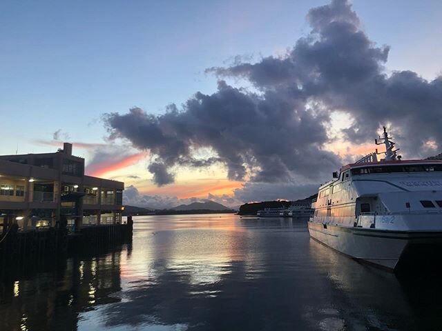
The island is a popular junk spot but also may be reached by ferry from Stanley and Aberdeen. Photo credit: visionsoftravel.org
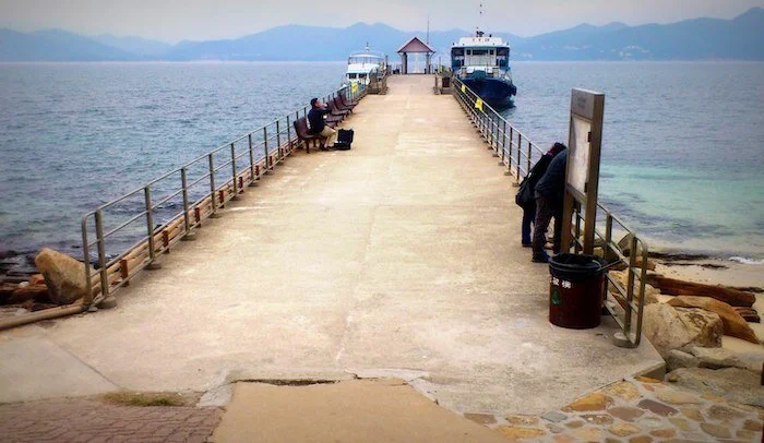
Starting Point — Po Toi Pier

Approaching the pier, you can catch a glimpse of the Conch Rock to your left. Go left from the pier and follow the trail to the right of the store. Photo credit: andystatham.com
Ngau Wu Teng Pavilion

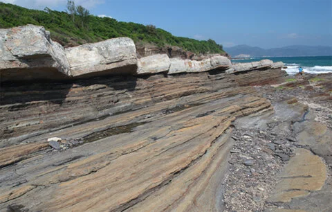
Walk across Cheung Shek Pai, a series of granitic rocks forming a natural track, and find yourself at the peak of the trail. Take a break at the pavilion to enjoy a boundless view of the South China Sea. Photo credit: blog.yacht.holimood.com
Monk Rock and Tortoise Rock

Descend until you are greeted by what seems to be a huge tortoise slowing making its way uphill, and a slender monk on the other side bowing at passers-by. Photo credit: webs-of-significance.blogspot.com
Nam Kok Tsui lighthouse and Gold Panning Cliff

Enjoy the magnificent sea view under Lighthouse 126. Continue down to Gold Panning Cliff, under which waves pound and seaweeds abound. Photo credit: ciaogogo.com
Palm Cliff

On your way back to the pier from Nam Kok Tsui, get a good look at the gigantic ‘palm of Buddha’ — a hand-shaped feature carved into the face of a cliff by the elements, which is one of the most recognisable landmarks of Po Toi. Photo credit: timeout.com
Endpoint — Rock Carvings

Follow the path down a flight of stairs to the shore to see 3,000-year-old rock carvings on a cliff in Nam Tum. A Declared Monument, these prehistoric totems have faded considerably and are currently protected by a sheet of fibre glass. Photo credit: dml.hk

Click here for a better resolution of Tung Chung to Tai O trail map.
Info:
Area: Outlying Island District
Starting point and Endpoint: Po Toi Pier
Average hiking time: About 2.5 hours
Distance: Approximately 4 km
Replenishing stations: There are eateries and a seafood restaurant near the pier, though no replenishments are available along the hiking trail.
Difficulty: Moderate - Steep climb and descent for the first half
How to get there:
To the starting point:
Board a kaito (small ferry) at Aberdeen Pier. The journey takes around an hour. This kaito service operates only on Tuesdays, Thursdays, Saturdays, Sundays, and public holidays; or,
board a kaito at Stanley Blake Pier. The journey takes around 30 minutes. This kaito service operates only on Saturdays, Sundays, and public holidays.
From the endpoint: Board a kaito at Po Toi Pier for Aberdeen or Stanley Pier.
For the kaito service schedule, please refer to the Transport Department website.