Posts tagged HK
Wilson Trail (Wong Nai Chung Reservoir to Stanley Gap Road) | 4.8 km | Very Difficult

The short yet challenging Section 1 of the Wilson Trail offers rewarding encounters with nature with its abundance of beautiful flowering shrubs. Once you’ve conquered Violet Hill and the Twins, the view on the ridgeline opens out to Stanley Village, D’Aguilar Peninsula, and the ocean beyond.

Wilson Trails at 70 kilometre long, has 10 sections which links the eight country parks from south to north of Hong Kong. Photo credit: timeout.com

Wilson Trails at 70 kilometre long, has 10 sections which links the eight country parks from south to north of Hong Kong. Photo credit: timeout.com

Wong Nai Chung Reservoir

Hong-Kong-Tour-Guides-Wong-Nai-Chung-Reservoir.jpg

Check out the Wong Nai Chung Reservoir Park before hiking uphill. Completed in 1889, some of the reservoir’s original components, including the weir, the dam, and the valve house, have been preserved, and are classified as Grade III historic buildings. Photo credit: fso-createhk.gov.hk

Violet Hill

Hong-Kong-Tour-Violet-Hill.jpg

After the park, return to Tai Tam Reservoir Road, then turn right to enter the Wilson Trail. On the trail, you will first tackle the relatively gentle Violet Hill, followed by the steeper ascent and descent of the Twins. From late January through early February, Violet Hill is covered in flowers. With their bell-shaped, violet-coloured blooms, the wild enkianthus shrubs will definitely grab your attention. Photo credit: urban-outdoors.com

Tze Kong Bridge

Hong-Kong-Tour-Agency-Tze-Kong-Bridge.jpg

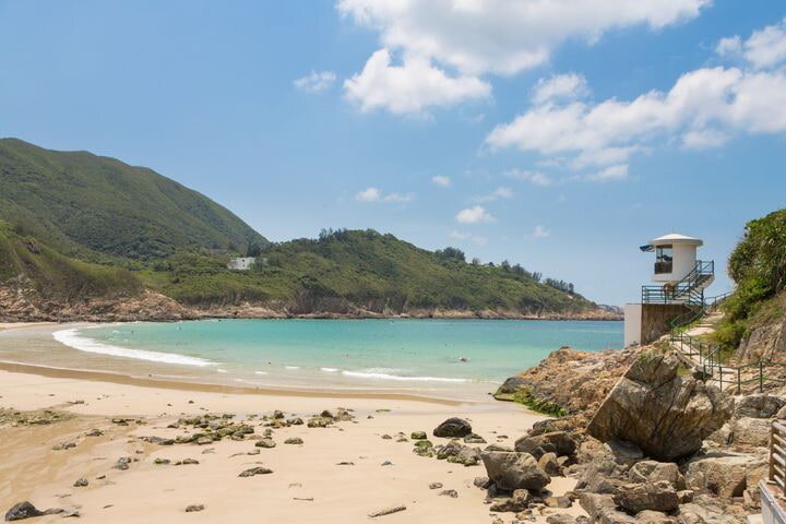
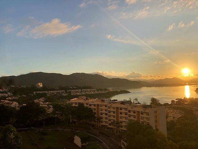
As you descend from Violet Hill, you can see Repulse Bay Beach. Upon crossing Tze Kong Bridge, follow the sign that directs you to Stanley Gap Road until you see a flight of 1,200 steps leading up to the Twins. Particularly from November through January, you’ll find the trail lined with abundant Polyspora axillaris flowers. They’re also known as the “fried-egg plants” because of the flower’s yellow and white colouration. Photo credit: photoblog.com

The Twins

Hong-Kong-Walking-Tours-The-Twins.jpg

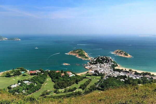
The wide-open view of Stanley on top of the Twins is a blissful finale to the hike. As you make your descent on Stanley Gap Road, spot the beautiful St. Stephen’s Beach, Stanley Peninsula, Stanley Main Beach, Murray House, and many more iconic attractions as you descend to Stanley Gap Road. Photo credit: pinterest.com

  • Trip ideas: Don’t pick the wild plants.

Click here for a better resolution of the Wilson Trail map.

Info:
Area:
Southern District
Starting point: Wong Nai Chung Reservoir
Endpoint: Stanley Gap Road
Average hiking time: 3 hours
Distance: About 4.8 km
Replenishing stations: No refueling stops along the hike. It’s essential to stock up on water and supplies beforehand.
Difficulty: Very Difficult - It’s a physically demanding hike with very little to no shade. A steep climb and descent near the Twins are to be expected.


How to get there:

  • From MTR Causeway Bay Station Exit D, take green minibus 5 at the crossroad of Jaffe Road and Cannon Street to Wong Nai Chung Reservoir. You can also take bus 76 on Pennington Street.

  • From MTR Hong Kong Station Exit D, take bus 6 at the Exchange Square Bus Terminus.

  • At the Wong Nai Chung Reservoir Park bus stop, you will see a petrol station. From there, cross the road and head up Tai Tam Reservoir Road to walk for about 10 minutes to Hong Kong Parkview. Wong Nai Chung Reservoir will be on your right.

    From the endpoint:

  • There are several bus routes you can take. Go to the other side of Stanley Gap Road, and take bus 6, 6A, or 260 to Wan Chai, Admiralty, or Central, or bus 73 to Aberdeen.

  • If you stay on the same side of the road, you can take bus 6, 6A, 73, or 260 to Stanley. You may catch a taxi ride back to Central from Stanley Gap Road.


With thanks to the Hong Kong Tourism Board and discoverhongkong.com for the content.

Tai Tam Country Park to Quarry Bay | 8km | Moderate

Built between 1883 and 1917, the Tai Tam Reservoirs were vital to the city’s urban development. Steady freshwater supply enabled industrial development to flourish. The area was so strategic that it became a battleground during World War II. Today, you can still find remnants of the war, such as pillboxes, bunkers and wartime communal stoves hiding in tranquil woodland.

The adjacent Tai Tam Country Park (Quarry Bay Extension) is a smaller sanctuary designated in 1979. Photo credit: industrialhistoryhk.org

The adjacent Tai Tam Country Park (Quarry Bay Extension) is a smaller sanctuary designated in 1979. Photo credit: industrialhistoryhk.org

Starting Point — Wong Nai Chung Reservoir

Hong-Kong-Day-Tours-Wong Nai Chung Reservoir.jpg

Literally ‘yellowish muddy creek’, Wong Nai Chung was dammed in 1899 to form Wong Nai Chung Reservoir. Have fun spotting kois, catfishes and tortoises. The nearby Wong Nai Chung Gap was a strategic defensive position during World War II. On 18 December 1941, Japanese troops began advancing up the hills from the north shore to capture the gap after some of the fiercest fighting of the invasion. Photo credit: thepoortraveler.net

Tai Tam Group of Reservoirs

Hong-Kong-Tours-Tai-Tam-Reservoir.jpg

Enjoy the shade as you pass by Hong Kong Parkview onto the paved path towards the reservoirs of Tai Tam. On any clear day, you’ll see perfect reflections of the hills and bridges on the glassy water surface.

To cater to the ever-increasing demand for water, towards the end of the 19th century, parts of the rugged valley of Tai Tam were dammed. The improved water supply made way for urbanisation to be extended from ‘Victoria City’ to the eastern side of Hong Kong Island. Photo credit: industrialhistoryhk.org

Quarry Gap

Hong-Kong-Tour-Quarry-Gap.jpg

Take a break at this crossroad of Mount Parker Road and the Hong Kong Trail. The Cantonese name of this hill pass, ‘Tai Fung Au’, means ‘windy gap’, and perfectly captures the breeziness of this hikers’ rest stop. Photo credit: topick.hket.com

Wartime Stoves

Hong-Kong-Tour-Agency-Wartime-Stoves.jpg

Follow the pleasantly shaded Mount Parker Road to the Hong Pak Country Trail, then turn onto the Quarry Bay Tree Walk. You will find dozens of field stoves, which were built as part of the city’s defence preparations during World War II. Photo credit: youtube.com

Woodside Biodiversity Education Centre

Hong-Kong-Tour-Woodside-Biodiversity-Education-Centre.jpg

From the end of the walk, continue on Mount Parker Road Green Trail for 15 minutes, until an exquisite red brick house comes into sight. Formerly the residence of Taikoo Sugar Refinery, which at one time was the world’s largest single unit refinery, this quaint mansion built in the 1920s was used briefly for refugees during World War II. Now, it showcases the biodiversity and conservation efforts in Hong Kong through interactive galleries.

End Point — Tong Chong Street

Hong-Kong-City-Tour-Tong-Chong-Street.jpg

As you finish the hike and head to MTR Quarry Bay Station, you’ll come across Tong Chong Street — literally ‘Sugar Refinery Street’ in Chinese. Glass-windowed skyscrapers have now replaced factory buildings, and cafés and pubs line both sides of the street instead of piles of sugar cane. Photo credit: zh.wikipedia.org

Click here for a better resolution of the Tai Tam Country Park to Quarry Bay map.

Info:
Area:
Southern and Eastern Districts
Starting point: Wong Nai Chung Reservoir
Endpoint: Tong Chong Street
Average hiking time: About 3 hours
Distance: Approximately 8 km
Replenishing stations: There is a supermarket at Hong Kong Parkview. Fuel up at cafés and restaurants on Tong Chong Street or King’s Road after the hike.
Difficulty: Moderate
Level and mostly shaded paths with some uphill sections

How to get there:

To the starting point:
From MTR Hong Kong Station Exit A, take bus 6 or 66 or from the Exchange Square bus terminus to Wong Nai Chung Gap Road.

From the endpoint:
Head to your next destination from MTR Quarry Bay Station.


With thanks to the Hong Kong Tourism Board and discoverhongkong.com for the content.

Peak Circle Walk | 3.5km | Easy

The top thing to do in Hong Kong is to take in the world-famous vista of Victoria Harbour from The Peak. Some of the best views are on the Peak Circle Walk, which winds around the highest point on Hong Kong Island.

Did you know?
There is more than one way to circle a peak. Do this walk in reverse, starting around 90 minutes before sunset, and you’ll be looking at Hong Kong Island’s scenic south side in the glow of afternoon light. You’ll be coming around to the north side, with views of the harbour, at just the right time, when twilight gives way to night and the city becomes a galaxy of shimmering lights.

The Peak Circle Walk loops around the highest point on Hong Kong Island, ensuring the best views from every angle. Photo credit: travelvui.com

The Peak Circle Walk loops around the highest point on Hong Kong Island, ensuring the best views from every angle. Photo credit: travelvui.com

Starting Point

Hong-Kong-Activities-Lower-Peak-Tram-Terminus.jpg

From MTR Central Station, Exit J2, walk to the lower Peak Tram terminus located on Garden Road for the scenic ride up to The Peak. Alternatively, you can take bus 15 from Exchange Square bus terminus, or minibus 1 from MTR Hong Kong Station public transport interchange. The Peak Circle Walk begins at Lugard Road near the Peak Tower. Photo credit: thepoortraveler.net

Lugard Road

Hong-Kong-Tour-Lugard-Road-Lookout.jpg

Built in 1913–14, this road is named after Hong Kong’s 14th governor, Sir Fredrick Lugard. The sections that are narrow, cliff-side paths are called ‘plank roads’. After about 20 minutes, you’ll arrive at the Lugard Road lookout, which offers a spectacular panoramic view of Victoria Harbour. Photo credit: dailytravelpill.com

Harlech Road

Hong-Kong-Tour-Agency-Harlech-Road-Waterfall.jpg

Lugard Road runs into Harlech Road, which will slowly take you back to The Peak Tower and to the end of your lap around The Peak. It takes about 15 minutes to traverse the entire tree-shaded path, or a bit longer if you stop to appreciate the waterfall falling below Mount Austin Playground. Watch out for those joggers rushing past: Harlech Road is one of their favourites. Photo credit: hk-victoria-peak.com

End Point

Hong-Kong-City-Tour-The-Peak-Tower.jpg

The walk will take you back to its starting point near The Peak Tower. From here you can catch the Peak Tram, bus 15 or minibus 1 back down to Central. Photo credit: thepeak.com.hk

Lung Fu Shan Country Park

Hong-Kong-Local-Tours-Lung-Fu-Shan-Country-Park.jpg

Take it farther! If time and energy are on your side, you can turn this leisurely stroll into a substantial walk to Lung Fu Shan Country Park. For something more in between, you can head to Pinewood Battery by turning right onto Hatton Road at the intersection of Lugard and Harlech roads. From here, take a tour of the University of Hong Kong and return to Central on bus 13 from Kotewall Road. Photo credit: flickr.com


Click here for a better resolution of The Peak map.

Info:
Area:
The Peak, Hong Kong Island
Starting point: Lugard Road
Endpoint: Harlech Road
Average hiking time: About 1.5 hours
Distance: 3.5 km
Replenishing stations: There is no replenishing station along the route. So before starting out, fuel up at a restaurant or stock up at a store in The Peak Galleria or The Peak Tower.
Difficulty: Easy


With thanks to the Hong Kong Tourism Board and discoverhongkong.com for the content.

Dragon's Back | 8.5km | Moderate

The last leg of the Hong Kong Trail, this meandering path on the ridge of Dragon’s Back is widely hailed as one of Hong Kong’s best urban hikes. Besides its attractive name, Dragon’s Back has a sightseeing platform near the peak that provides truly spectacular views of southern Hong Kong Island and its shoreline. Right at the trail’s end is Big Wave Bay. Take a dip or surf the waves for a relaxing finale to this hike.

It is arguably the best hike on Hong Kong Island. Photo credit: traveller.com.au

It is arguably the best hike on Hong Kong Island. Photo credit: traveller.com.au

Shek O Peninsula Viewing Point

Hong-Kong-Day-Tours-Shek-O-Peninsula-Viewing-Point.jpg

From Shek O Road, you will first walk through a shaded path onto this section of the Hong Kong Trail. About a minute into your hike, the path will open up to the sky as you ascend. After 20 minutes or so, you’ll find yourself on the Shek O Peninsula Viewing Point overlooking Shek O Beach on the foot of the hill, and also the two isles off Shek O Peninsula. Photo credit: canon.com.hk

Shek O Peak

Tours-in-Hong-Kong-Dragons-Back-Shek-O-Peak.jpg

Although bare and exposed, the platform on the summit of Shek O Peak (284 m) is the perfect place to take in the panorama of the peninsula’s coastline. When you turn around to observe the winding trails, you’ll finally see how Dragon’s Back got its well-deserved name. Photo credit: themcnuggetsqueen.com

Dragon’s Back & Pottinger Gap

Hong-Kong-Walking-Tours-Dragons-Back-Pottinger Gap.jpg

Stay on the rolling ridge to trace the “dragon” while you climb uphill. Stop at the Dragon’s Back Viewing Point for a great view of the Tai Tam Bay west of Shek O Peninsula. On a clear day, even Lamma Island, to the southwest of Hong Kong Island, is visible from the deck. Once over the ridge, you'll arrive at Pottinger Gap. Here you get a view of Chai Wan’s urban high-rises against a forested landscape. Photo credit: walkonhill.com

Big Wave Bay

Tours-in-Hong-Kong-Big-Wave-Bay.jpg

After passing a pavilion, you’ll begin a sharp descent on an uneven stone and dirt path. This very last stage of the trail is mostly shaded and can be slippery at times. Once you’ve exited the trail and cleared the village houses, a beach popular with surfers lies waiting. Big Wave Bay will greet your arrival with shimmering white waves against the blue sky. Photo credit: thetraveler.net

Trip ideas: If you plan on watching the sunrise or sunset on Dragon’s Back, check the Hong Kong Observatory website for the exact times: www.hko.gov.hk


Click here for a better resolution of the Dragon's Back’s trail map.

Info:
Area:
Southern District
Starting point: Shek O Road near To Tei Wan Village
Endpoint: Big Wave Bay
Average hiking time: 4 hours
Distance: About 8.5 km
Refuel: There are no refueling stops along the trail.
Difficulty: Moderate
Most of the route is on dirt paths. The first half has very little shade, and there is also a steep 200-meter-long uphill stretch. The flight of descending stone steps in the last section is quite steep, too.


How to get there:

To the starting point:
From MTR Shau Kei Wan Station Exit A, walk to the Shau Kei Wan Bus Terminus. Take bus 9 or the red minibus with the sign “Shek O” to the To Tei Wan stop on Shek O Road.

From the endpoint:
Take the red minibus with the sign “Shau Kei Wan” or a taxi from Big Wave Bay back to Shau Kei Wan.


With thanks to the Hong Kong Tourism Board and discoverhongkong.com for the content.